0
0,00 0 items

No products in the cart.

Blank maps bundle, Spain, Europe and World maps

Original price was: 27,00€.Current price is: 22,00€.

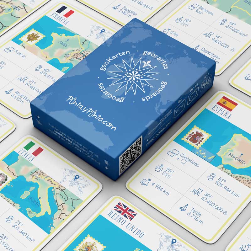
Learn geography and the giant silent maps pack. Includes downloads of several A4 pdf maps, digital versions and interactive games.

9,00
9,00
9,00
More information
icono de ampliar información.

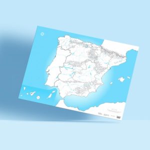
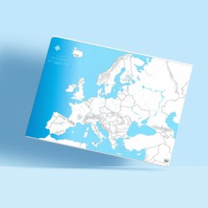
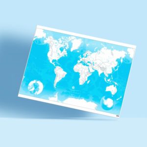
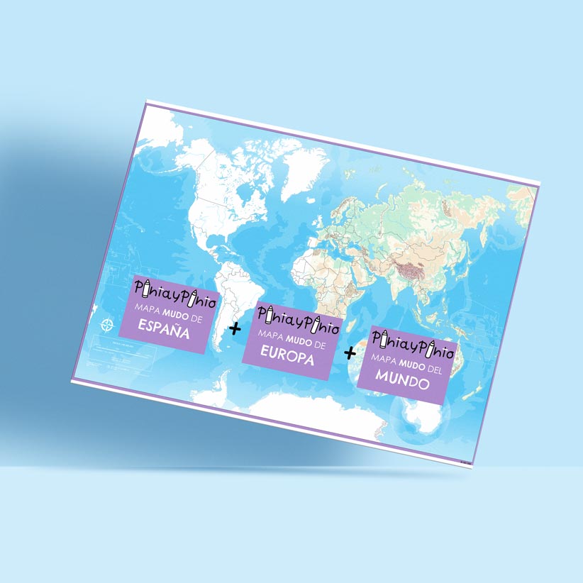
Blank maps bundle, Spain, Europe and World map, perfect for home or classroom use. Includes an online version with interactive maps and challenges. Downloadable maps included.

Enjoy and learn from this activity with family or friends.

Includes: 3 poster + 48 stickers for labelling.
Format: 100 x 70 cm rolled.
Packaging: 71 x 7 x 7 cm.
Material: high-quality extra white 150 gsm paper. Colour with markers, pencils, crayons - you choose!
Designed and manufactured in Spain.
Usage: up to 6 children at the same time, place it on the floor, table, or wall, and get ready to learn and collaborate.
Delivery
icono de ampliar información.
Free Shipping: on orders over €30 in mainland Spain and Balearic Islands.
Super Reduced: €2 mainland Spain and Balearic Islands, €3 Canary Islands, Ceuta, and Melilla, €5 Europe, €9.5 rest of the world.
Shipping via postal service, usually 4- working days without tracking.
Express: €5.99 mainland Spain and Balearic Islands, €20 Europe.
cover of the video about the world map of pinta y pintoIcono de reproducción

Blank maps bundle, Spain, Europe and World maps

  • Blank maps bundle: Spain, Europe, and the World, printed on high-quality paper (100 cm x 70 cm).
  • Includes an interactive digital version with Genially.
  • Free PDF downloads of a collection of physical and political maps.
  • A complete and versatile educational resource. Includes 48 Velcro pieces for custom labels.
  • Perfect for fun and engaging family learning.
Blank map of Spain with labels of the provinces and velcro of the downloadable en pide.

Giant and high quality

With our blank maps bundle of Spain, Europe and World map you can study every corner of world geography, whether it's on the table or on the wall.

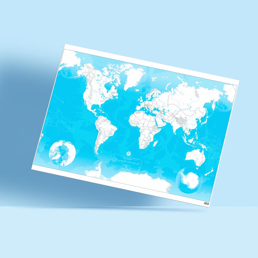
100x70 cm, high quality paper + interactive digital version + free A4 PDF downloads of physical and political maps.

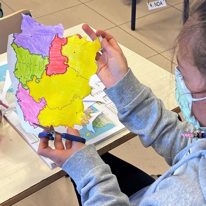
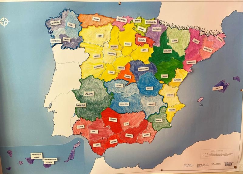
High quality paper, with which you can colour with markers, pencils, crayons and even watercolours.

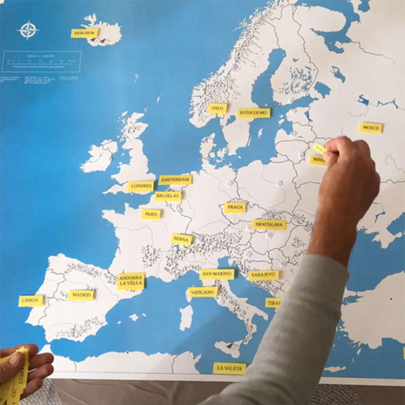
Personalise your learning with the 48 velcro fasteners included, creating labels that adapt to your topics and facilitating interactive games in class or at home.

blank maps bundle, Spain, Europe and the world for coloring
Interactive game to find the most important mountain ranges in Europe.

Interactive digital version with games

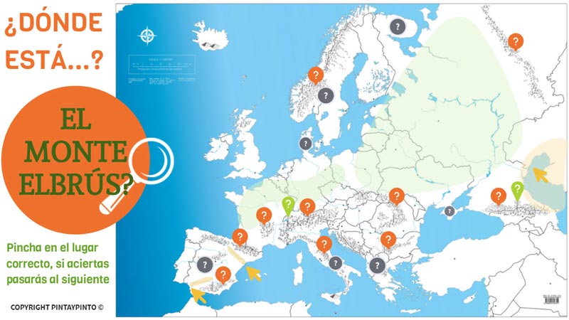
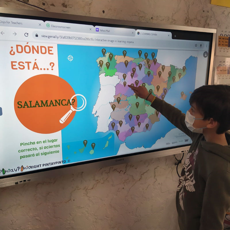
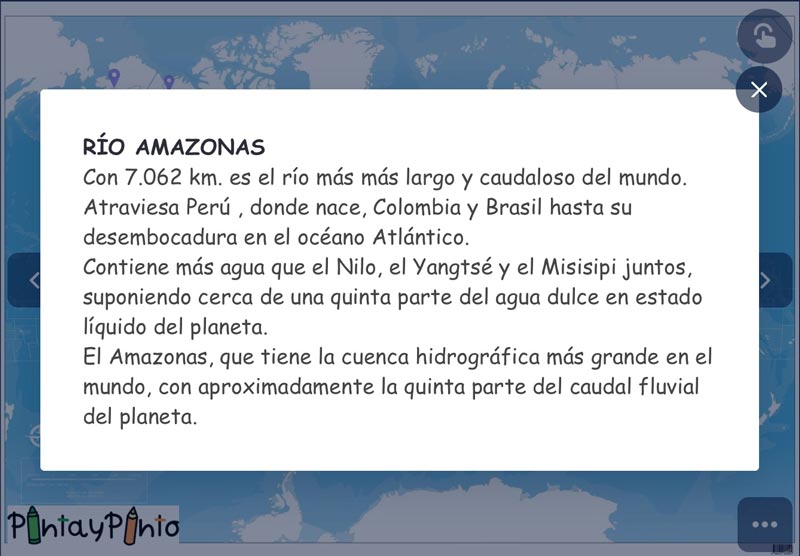
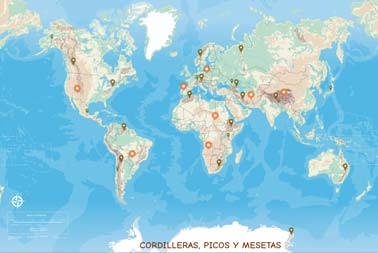
With the digital version of the blank maps you can personalise your learning with different variations of physical and political maps. Discover country names, rivers, seas, mountain ranges and much more.

Interactive challenges make learning a game, offering a fun way to review your knowledge.

Access the digital version through Genially.

blank maps bundle, Spain, Europe and the world for coloring
Downloadable A4 PDFs of North and Central America.

Downloadable blank maps bundle, PDF printable maps in A4 format

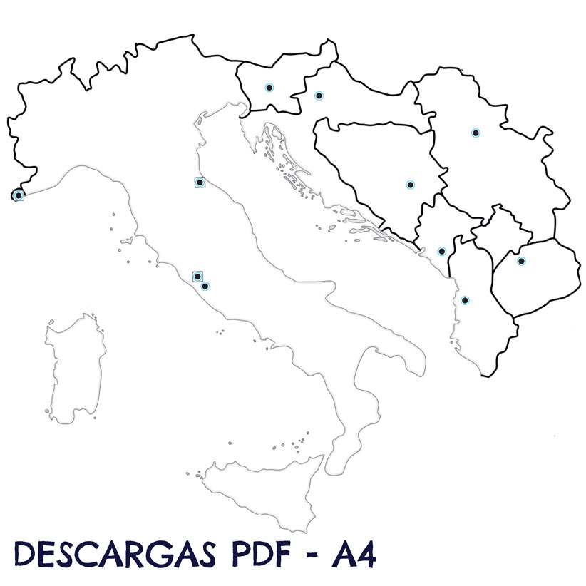
Take advantage of our complete collection of free maps in PDF. Download different detailed physical map to explore the geography, mountain systems, follow the courses of rivers, and learn about the countries, capitals. Also included political and thematic maps.

In addition, we have prepared some A4 PDFs of the countries that can be cut out, with flags, names of rivers, mountain ranges capitals, etc., to work individually or in groups and do collaborative projects.

blank maps bundle, Spain, Europe and the world for coloring
Girl cutting out after painting the downloadable PDF A4 of the autonomous communities in class.

Educational and Fun

The versatility of the blank maps bundle, together with the digital versions, interactive games and free PDF downloads will facilitate classroom learning and teamwork.

All these tools provide a unique way to assimilate information while awakening your creativity. This interactive educational approach is suitable for all ages, fusing knowledge with fun.

Included with the silent maps pack

Labels of the names of Spanish cities with the Velcro included in the map to create a game.
Velcros included

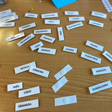
48 velcros fasteners included to put all the labels that suit your needs to name or identify mountain ranges, rivers, seas, capes, provinces.

It is very versatile, so we can use it in other subjects such as history, languages, mathematics (using the scales).

Explanation of the Amazon River on the interactive world map.
Digital blank maps

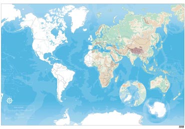
The blank maps bundle includes a collection of digital versions, physical and political maps with and without borders.

Interactive maps of:

  • Main rivers, seas, and oceans with a brief description.
  • Mountain ranges, major peaks, and geographical features.
  • Continents, countries, borders, and capitals.
  • The maps of Spain and Europe are available in English, Catalan, Basque, and Galician through Genially.
Interactive game about the mountain ranges, peaks and mountains of the world.
Interactive Games

Interactive games to test our knowledge of:

  • Hydrography.
  • Mountain ranges and peaks.
  • Coasts and islands.
  • Continents, countries, and capitals.
9,00
9,00
9,00
crossmenuchevron-right