

ESP

Original price was: 22.95€.19.95€Current price is: 19.95€.
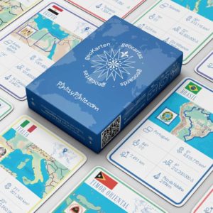
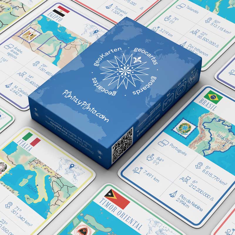
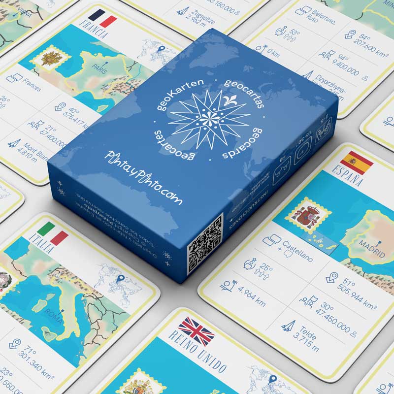
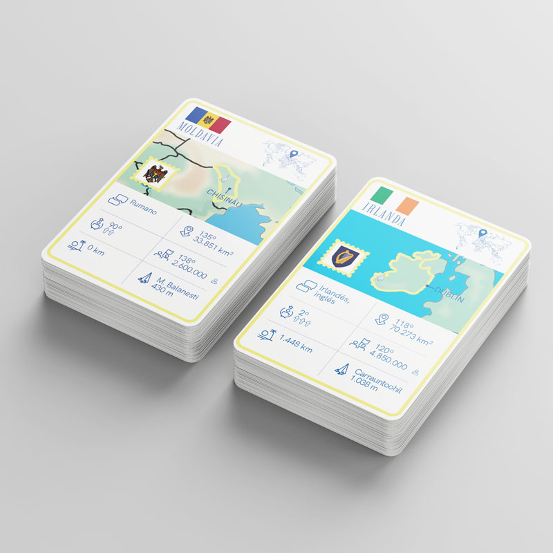
European geography game, with 48 country cards and 6 special cards. Different game modes. Includes mute map of Europe.


Geocartas Europe is more than a game; it is an educational tool that makes learning geography fun.
With different game options, from easy to hard, every game is an opportunity to strengthen your knowledge.
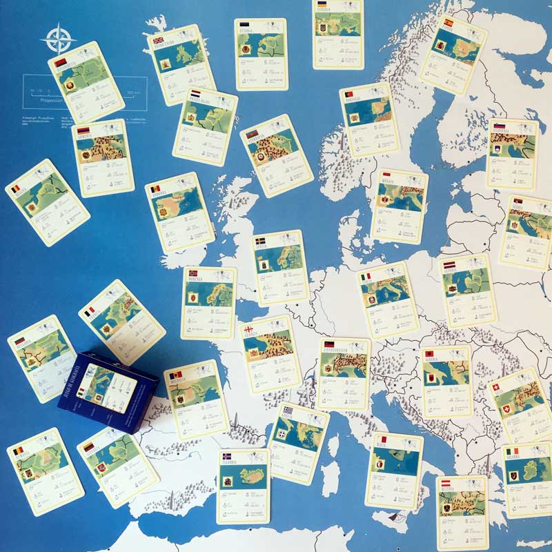
48 country cards, 6 special cards + a giant blank map that serves as a board.
Perfect for family play or educational environments, Geocartas Europe is suitable for ages 8 and up. In addition, the cards function as valuable educational flashcards.

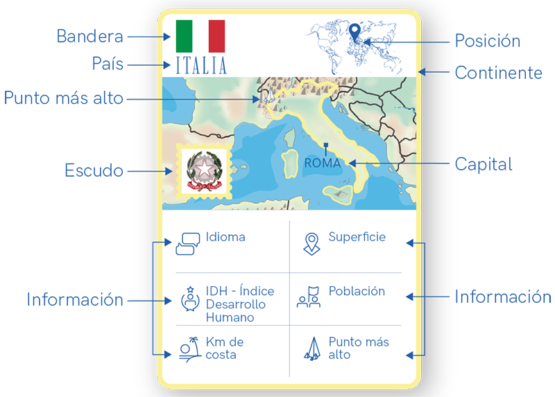

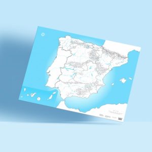
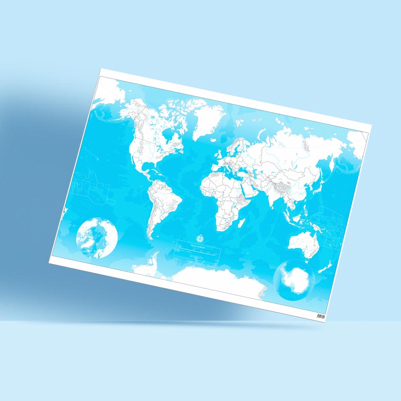
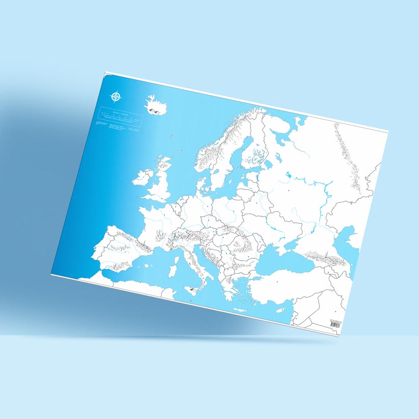
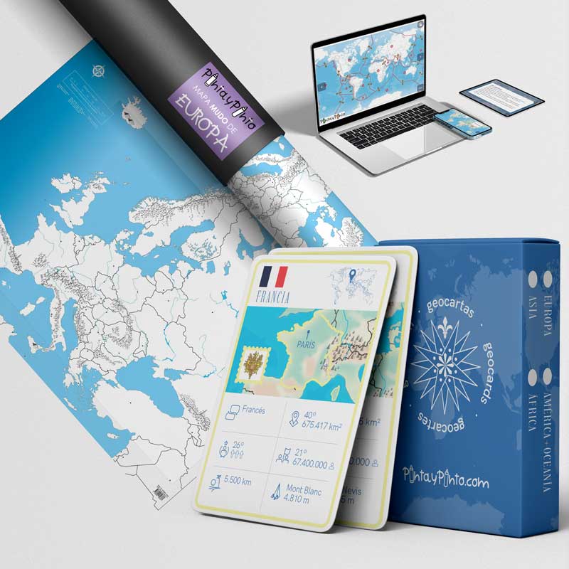
Together with the Geocartas Europe you will receive a 100 cm x 70 cm silent map of Europe. The giant map will help you to better understand the position, surface, borders, mountain ranges, capitals and much more. During the game you can also add a rule to find the country on the map.
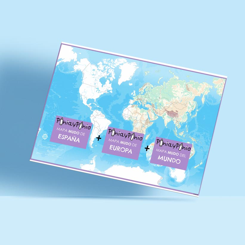
To deepen your geography knowledge you can also download our complete collection of free PDF maps. Download the various silent maps of Europe detailing the physical geography, political and thematic maps, to explore mountain systems, follow the courses of the continent's main rivers, learn about countries, borders and capitals.

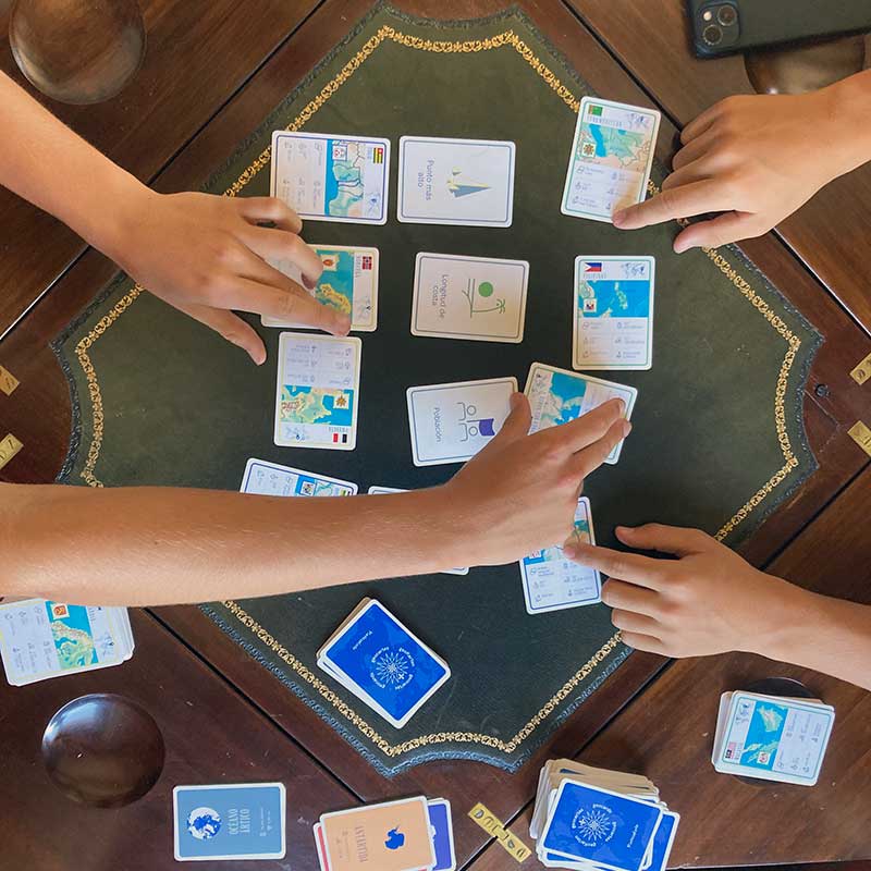
The versatility of Geocartas allows us to play them at home, in class or even just to review our knowledge.
At home, these cards provide an exciting opportunity for the family to explore the fascinating world of European geography together in a relaxed and fun environment.
In the classroom, these cards become powerful educational tools, gamifying the teaching of geographical concepts in an interactive and dynamic way.
Geocartas Europe can also be used as flashcards, allowing students to consolidate their knowledge individually or in study groups.
For players aged 8 years and up.
Various game modes to suit different ages and levels of challenge, providing edutainment opportunities for the whole family.
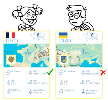
Each player receives 5 cards, and the player must study their card and choose the feature they think has the best chance of winning, be it surface area, HDI, km of coastline, etc.
The player with the highest value wins and gets to keep the other players' cards. In each round a different feature can be chosen.
The player who keeps all the cards wins.
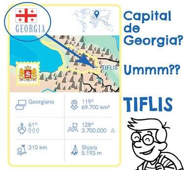
Each player receives 5 cards. Challenge your opponents to name the capital of your country from your card and indicate it on the map ..... If they answer correctly, they get to keep your card. If they fail, you get to keep their card...... Whoever has the most cards wins.
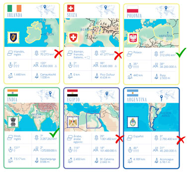
Each player receives 5 cards and chooses a feature for the game, in this example country surface. The player with the highest value wins and gets to keep the other players' cards. Ideal for developing knowledge, which country is bigger, has a higher population, has a higher development index, etc. You will be surprised!
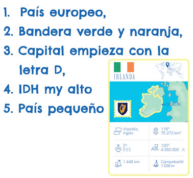
This is a more difficult version of the game. Each player receives 5 cards. The player asks questions about the country they have to guess, for example: continent? 2 colours of the flag? has a coastline? first letter of the capital? population less than 5 million? Only 5 questions can be asked, and you have to answer.